媒体英语
Elephants counted from space for conservation 科学家利用卫星图像统计非洲大象的数量
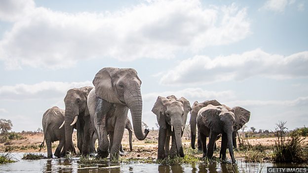
科学家们首次利用卫星图像统计非洲大象的数量。照片由一颗在地表 600 公里( 372 英里)外轨道上运行的地球观测卫星拍摄。这一突破可以让人们在无云日里对 5000 平方公里的大象栖息地进行观测。
When you first look at it, the image is a series of grey blobs amid a forest of green splotches. But when you study it closely, the picture the researchers are using, taken from space, is of a herd of elephants wandering through the trees.
乍眼一看,这些图像是绿色斑点状森林中的一块块灰色团状物。但当你仔细观察后会发现,研究人员们所使用的这张从太空中拍摄的照片其实是一群在林间漫步的大象。
The scientists used a series of these images – pictures of one National Park in South Africa, taken by a satellite – to test a new way of monitoring the African elephant population.
科学家们利用了一系列由卫星拍摄的南非一个国家公园的图像,来测试一种用于监测非洲大象数量的新方法。
The laborious task of actually counting the animals was all done via machine learning. By essentially showing a computer dozens of these pictures, the researchers trained it to correctly pick out and count elephants amid trees, rocks and other animals.
实际统计动物数量的艰巨任务是通过机器学习算法完成的。实际上就是通过向电脑展示几十张这样的照片,研究人员训练计算机在树木、岩石和其它动物中正确识别并清点大象的数量。
The scientists say this combination of space-based imaging and artificial intelligence could boost conservation efforts by allowing thousands of square miles of habitat to be surveyed in a single day.
科学家们表示,结合天基成像和人工智能,可以在一天之内对数千平方英里的大象栖息地进行观测,从而促进动物保护工作。
词汇表
blobs 团
splotches 斑点,污点
herd (动物)群
wandering 游荡,漫步
satellite 人造卫星
monitoring 监测
machine learning 机器学习
combination 结合,组合
space-based imaging 天基成像
artificial intelligence 人工智能
boost 促进,推动
habitat 栖息地
阅读理解:请在读完上文后,回答下列问题。
1. True or false? The pictures mentioned in the text were taken in a National Park in South Africa.
2. For what purpose did the scientists use the images?
3. How was the task of counting elephants carried out?
4. According to the scientists, what could the combination of space-based imaging and artificial intelligence mean for the future?
答案
1. True or false? The pictures mentioned in the text were taken in a National Park in South Africa.
False. These pictures were taken from space by a satellite.
2. For what purpose did the scientists use the images?
They used them to test a new way of monitoring the African elephant population.
3. How was the task of counting elephants carried out?
The laborious task of actually counting the animals was all carried out via machine learning.
4. According to the scientists, what could the combination of space-based imaging and artificial intelligence mean for the future?
They say it could boost conservation efforts by allowing thousands of square miles of habitat to be surveyed in a single day.