中国网站品牌栏目(频道)

STEVE EMBER: This is Steve Ember.
BOB DOUGHTY: And this is Bob Doughty with the VOA Special English program EXPLORATIONS. Today, we tell about how people learned an important piece of information necessary for safely sailing on the oceans. It is called longitude.
(MUSIC)
STEVE EMBER: On a foggy October night in 1707, four English navy ships hit rocks in the Atlantic Ocean and sank. Two thousand men drowned. The ships had been sailing in the thick fog for 12 days. There was no sure way to know where they were. The commander of the ships had been worried that they could hit rocks if they were not careful. He asked his navigators for their opinion on their location in the ocean.
The navigators did not really know. They told the commander they thought they were west of a small island near the coast of northwestern France.
They were wrong. Instead, they sailed onto rocks near a small group of islands southwest of England's Atlantic coast. The navigators' lack of knowledge led to the loss of four ships and 2,000 lives.
BOB DOUGHTY: When people began sailing out of sight of land, sailors did not know how to tell where they were on the open sea. Land travelers can look at a mountain, or a river, or an object that shows them where they are in relation to where they came from. On the ocean, however, there is no sign to tell a sailor where he is.
The most important device for knowing directions on the ocean is a compass. A compass is a device containing a metal object that points toward the magnetic north pole. This shows navigators the direction of north, and therefore also south, east and west. But sailors need more information to sail safely on the open sea.
STEVE EMBER: Most maps of the world show lines that are not on the Earth's surface. One line is the equator. It is an imaginary line around the widest part of the Earth. There are similar lines both north and south of the equator. These circles become smaller and smaller toward the north pole and the south pole.
These lines, or circles, are parallel -- meaning that they are equally distant from each other at any point around the world. These lines show what is called latitude.
A navigator can know the latitude of his ship by observing the location of stars, where the sun rises in the morning and sets in the evening, and what time of year it is. With this information he knows where his ship is in relation to the north or south pole and the equator.
BOB DOUGHTY: Still, there is one more important piece of information necessary for safely sailing the oceans. For many centuries, scientists, astronomers and inventors searched for a way to tell longitude. The lines of longitude go the other way from latitude lines. They stretch from the north pole to the south pole, and back again in great circles of the same size. All of the lines of longitude meet at the top and bottom of the world.
In her book, "Longitude," writer Dava Sobel tells the story about longitude and how the problem of knowing it was solved.
(MUSIC)
STEVE EMBER: For centuries, the great scientists of the world struggled to develop a way to learn longitude. To learn longitude at any place requires knowledge about time. A navigator needs to know what time it is on his ship and also the time at another place of known longitude -- at the very same moment.
The Earth takes 24 hours to complete one full turn or revolution of 360 degrees. One hour marks one 24th of a turn, or 15 degrees. So each hour's time difference between the ship and the starting point marks a ship's progress of 15 degrees of longitude to the east or west. Those 15 degrees of longitude mark a distance traveled.
At the equator, where the Earth is widest, 15 degrees stretches about 1,600 kilometers. North or south of that line, however, the distance value of each degree decreases. One degree of longitude equals four minutes of time all around the world. But in measuring distance, one degree shrinks from about 109 kilometers at the equator to nothing at the north and south poles.
BOB DOUGHTY: For many centuries, navigators hoped they could find longitude by observing the movement of stars at night. During the day, the sun provided information about the time on a ship, and its direction. However, it did not provide necessary information about the time somewhere else.
In the 16th century, one astronomer suggested that navigators could observe the moon as it passed in front of different known stars to tell longitude. But, there was not enough information about the stars to use this method effectively. Astronomers could not tell exactly where the moon would be from one night or day to the next.
Yet it seemed to those seeking to solve the longitude problem that the only solution was in the moon and stars.
(MUSIC)
STEVE EMBER: During the 17th century, English astronomers began a major effort to map the stars and their relationship to the moon as it passed across the sky. Royal Astronomer John Flamsteed worked at this task for 40 years. The next Royal Astronomer, Edmund Halley, spent another 40 years gathering information about the moon's orbit.
After many years of gathering the necessary information, it became possible to learn longitude by observing the stars and the moon. In 1766, Royal Astronomer Nevil Maskelyne published the Nautical Almanac and Astronomical Ephemeris. It contained all the necessary information about the moon and stars that sailors would need to help them learn their longitude.
This new method was not simple. A navigator had to use complex observing instruments to note the position of the moon and stars. Then he had to seek the correct information in the Nautical Almanac about the moon and stars at that time of night or day. The final step in the process was to take the mathematical information from the book, link it to the current information and solve the resulting problem. This took an average of four hours to do.
|
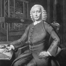 John Harrison |
His task also was difficult and complex. Mr. Harrison had to develop a clock that was not affected by the movement of a ship on the ocean or changes in temperature or atmospheric pressure.
He began developing his clock in 1730. It took five years to complete. The complex device weighed 34 kilograms. Several years later, Mr. Harrison built a second clock. It was smaller, but weighed more than the first. Mr. Harrison was not satisfied and began working on yet another device.
Twenty years later, he completed a device that was smaller than the first two, and weighed less. But still Mr. Harrison was not satisfied.
Two years later, in 1757, he produced a small clock that he could hold in his hand. The clock could tell the correct time in two places, meeting the requirements for learning longitude on the sea.
STEVE EMBER: For many years after Mr. Harrison's work was completed, the idea of using a clock to learn longitude was rejected. However, that opinion changed when manufacturers learned how to make better and less costly versions of Mr. Harrison's clocks. The clocks became known as chronometers.
|
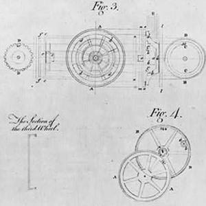 Details of a chronometer designed by John Harrison |
BOB DOUGHTY: John Harrison's clocks can be seen today at the Old Royal Observatory in Greenwich, England. The first three are still operating, showing the correct time. To look at them is to see the simple solution to a problem that worried people for many centuries.
Today, the solution to the problem is so common that it is difficult to understand that there was a problem at all.
(MUSIC)
STEVE EMBER: This program was written by Oliver Chanler and produced by Paul Thompson. Our audio engineer was Al Alaby. This is Steve Ember.
BOB DOUGHTY: And this is Bob Doughty. Join us again next week for EXPLORATIONS, a program in Special English on the Voice of America.
almanac: a book that is published every year giving information for that year about a particular subject or activity(年鉴)
Remembering the X-15, America's first step in manned space flight
Climbers break new records reaching the top of the world's highest mountain
Celebrating art's past and present, at the Louvre
Amelia Earhart: the first woman to fly across the Atlantic alone
(来源:VOA 编辑:陈丹妮)